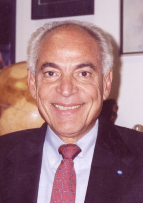
Text Box:

El Baz, Farouk

Dr. Farouk El-Baz is Research Professor and Director of the Center for Remote Sensing at Boston University. He received his BSc (1958) in Chemistry and Geology from Ain Shams University, Cairo, Egypt; and MSc (1961) and PhD (1964) in Geology from the Missouri School of Mines and Metallurgy. He taught geology at Assiut University (1958–1960), and Heidelberg University (1964–1966). He received an honorary Doctor of Science from New England College (1989), and an honorary Professorial Degree from the University of Missouri–Rolla (2002).

Dr. El-Baz participated in the Apollo program (1967–1972) as Supervisor of Lunar Science Planning at Bellcomm, Washington DC, as Secretary of the Site Selection Committee, Chairman of the Astronaut Training Group, and Principal Investigator for Visual Observations and Photography. From 1973 until 1983, he directed the Center for Earth and Planetary Studies at the National Air and Space Museum, Smithsonian Institution, Washington DC. In 1982–1986 he was Vice-President for Science and Technology at Itek Optical Systems of Lexington, Massachusetts.

He served on the Steering Committee of Earth Sciences of the Smithsonian Institution, the Arid and Semi-Arid Research Needs Panel of the National Science Foundation, and the Lunar Nomenclature Group of the International Astronomical Union. In 1985 he was elected Fellow of the Third World Academy of Sciences and represents the Academy at the Nongovernmental Organizations Unit of the Economic and Social Council of the United Nations. He served as Science Advisor (1978–1981) to President Anwar Sadat, and was elected in 2002 to the U.S. National Academy of Engineering.

Dr. El-Baz pioneered research in the applications of space photography to desert study, particularly the location of groundwater resources. His present research objectives include applications of remote sensing technology to archaeology, geography and geology. He is President of the Arab Society of Desert Research and the recipient of numerous honors and awards, including the Arab Republic of Egypt Order of Merit–First Class.


MATHEMATICS AND SCIENCE EDUCATION OF PRIMARY SCIENTIFIC KNOWLEDGE OF THE LAND AS A TOOL FOR DEVELOPMENT

Detailed scientific knowledge of the land and its resources is an essential component of economic development. History proves that those who established lasting civilizations, starting with the ancient Egyptians, knew their land well and fully utilized their natural resources. This is attained only through long-term emphasis on this knowledge in the educational system. Nowhere is this needed more than in the Arab world in general and in Egypt in particular. Ignorance of the basic geography and the nature of the environment throughout the Arab region must be remedied through science education.

Worldwide emphasis on fast-paced economic development necessitates attention to the environmental consequences. Improving and/or sustaining the environment are prerequisites for proper development in the long-term. Therefore, monitoring changes in the environment is also an important tool for sustainable development.

Digital data and information pertaining to the environment should be an integral part of the discussion of science education. Satellite image data from numerous sources (on the atmosphere, the land surface and coastal zones) form a basic component of the requirements. Two or more digital images of the same object or phenomenon can be superposed (using widely available tools of information technology hardware and software) to instantly display the change from one time to another. Therefore, such data should be made available as widely as possible to development planners in the Arab world. This is necessary to such basic issues as how much land is under cultivation, which are not adequately treated.

This paper presents the case for use of satellite images to make the necessary information available to students and teachers. There is no question that access to such data can lead to a better understanding of the land, its resources and its environmental characteristics. Satellite image data should be made available for use in the classrooms at all levels. Only then can we assure the availability of basic data in an easily understood form and the monitoring of environmental changes in a timely manner.