02 June 2007
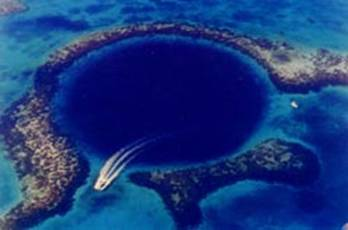
The Great Blue Hole
Credit: USGS
A NASA-funded, pioneering research recently succeeded to explore the world's deepest water-filled sinkhole, El Zacatón sinkhole, Mexico.
In late May 2007, The Deep Phreatic Thermal Explorer (DEPTHX), a robotic vehicle designed for underwater exploration, plunged repeatedly into the depths of the previously unexplored sinkhole. DEPTHX reached the sinkhole's bottom, 318 m below the surface. The vehicle employed autonomous navigation and mapping systems, producing a sonar map of its inner dimensions. These techniques were developed by Carnegie Mellon University's Robotics Institute.
A sinkhole, also known as cenote, is a natural depression in Earth's surface, caused by the action of water. Sinkholes are up to several hundred meters across, and some are very deep. They are found worldwide.
During the two-week research expedition, led by Bill Stone of Stone Aerospace, DEPTHX showed that the geothermal sinkhole did not have a tunnel or any other obvious underwater connections with neighboring cenotes in the Mexican state of Tamaulipas. DEPTHX also collected numerous samples of water and the gooey biofilm covering the cenote's walls.
"We are very pleased about the performance of the DEPTHX system," said David Wettergreen, a principal investigator of the research team. "We hit our technical objectives in creating a system that could explore and map autonomously."
DEPTHX tested technologies and methods that would be applied in a future space project, the exploration of possible oceans believed to exist beneath the icy crust of Europa, Jupiter's intriguing moon. Also, NASA recently approved a project that will apply these technologies to explore Antarctica's West Lake.
DEPTHX, 2.5 meters in diameter, included 56 sonars that the Carnegie Mellon team used to determine the location of the vehicle as it explored the cenote. It also applied the sensors to generate maps of the sinkhole's interior via a technique called Simultaneous Localization and Mapping (SLAM). Prior to the DEPTHX plunge, SLAM had been used for navigating in mines.
Robots typically navigate by recognizing features, but cenote walls, while irregular, lack distinctive features. To overcome this challenge, DEPTHX had to navigate by recognizing a more global response from all of its sensors. Wettergreen mentioned that SLAM would be employed in exploring rivers and mines.
Intriguingly, DEPTHX was initially tethered, but eventually it operated autonomously, without a tether or human guidance, for eight hours at a time. "The fact that we never lost it, never required a rescue mission, is an achievement itself," said Wettergreen.
Further Reading
NASA-Funded Robotic Sub finds Bottom of World's Deepest Sinkhole
http://www.cmu.edu/news/archive/2007/May/may31_depthx.shtml
Aymen Mohamed Ibrahem