Lecture: Atlas of Historic Urban Development of Cairo at Beginning of Twentieth Century
Posted on
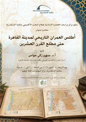
The Center for Islamic Civilization Studies at the Academic Research Sector of the Bibliotheca Alexandrina is organizing a lecture entitled “The Historical Urban Atlas of Cairo up to the Beginning of the Twentieth Century”. The lecture is delivered by Prof. Dr. Soheir Zaki Hawas, Professor of Architecture and Urban Design at Cairo University’s Faculty of Engineering, on Wednesday, October 14, 2026, from 2:00 to 5:00 p.m. at the Bibliotheca Alexandrina Conference Center, Delegates Hall.
The lecture highlights Cairo’s urban development through the patterns of everyday life and the distribution of economic and social activities documented by Dr. Soheir Zaki Hawas in the Historical Urban Atlas of Cairo. The atlas includes around 800 historical maps of Cairo spanning different periods, providing a visual record of the city’s transformations and offering insights into how Cairo’s society lived and interacted with its urban surroundings in the past.
The Historical Urban Atlas of Cairo draws on two main types of map archives. The first dates back to the sixteenth century and consists of maps and artistic depictions produced by European artists and travelers, who portrayed Cairo as they saw it or imagined it. The second comprises maps depicting the city of Cairo in its entirety at different scales.
The lecture is part of the Center for Islamic Civilization Studies’ efforts to promote greater awareness and understanding of Egypt’s historical and urban heritage among specialists, researchers, and those interested in architecture and Islamic civilization.