Projects
Heritage Preservation: Reconstructions: Ancient Alexandria
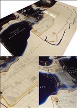
This scale model of ancient Alexandria is based upon the 1866 map by Mahmoud El Falaki. The streets are laid out in a grid pattern. The two main arteries are the Canopic Way (corresponding to Fouad Street today) which extends from east to west, and the Soma, extending from north to south. This reconstruction includes the Island of Pharos and the Heptastadium which connects it to the mainland. The model also shows public buildings and the ancient and Arab city walls.