| front |1 |2 |3 |4 |5 |6 |7 |8 |9 |10 |11 |12 |13 |14 |15 |16 |17 |18 |19 |20 |21 |22 |23 |24 |25 |review |
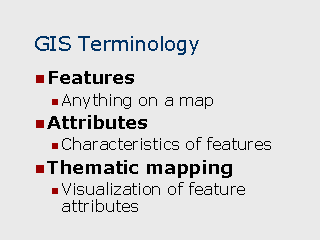 |
Features – Geographic
features are specific places on a map. Features can be addresses, roads, regions, etc. Attributes – Attributes are literally database fields that describe geographic features. Each layer in a GIS can be thought of as table in a relational database. Attributes represent a database table which is linked to a geographic layer. Each record in the table corresponds to a geographic feature in the layer and its fields Thematic mapping – Also sometimes called "theme mapping", it is a data visualization technique where the attributes of geographic features are displayed graphically on a map. For example, a map showing census tracts which are color coded on the basis of the number of households residing in each tract. Thematic maps can also be applied to point locations, such as a map showing hospital locations where the size, color, and symbol indicate the type of hospital and the number of beds. |