| front |1 |2 |3 |4 |5 |6 |7 |8 |9 |10 |11 |12 |13 |14 |15 |16 |17 |18 |19 |20 |21 |22 |23 |24 |25 |review |
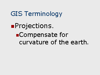 |
Projection – Since
the earth is round and not flat, simple XY coordinates become inaccurate over longer
distances due to the earth’s curvature. Projections are mathematical algorithms to
adjust coordinates such as latitude and longitude for the curvature. Typical projections
include:
The significance to projection methods is that GIS users must be aware of the method(s) associated with geocoded datasets and geography files so that layers using different projections are not mixed on the same map. Most GIS software will automatically distinguish between layers using different methods and warn the user that the methods are inconsistent. Geocoded datasets, however, can be more problematic since they may not carry the projection method used to assign the coordinates, leaving the user to keep track of the method and ensure that it matches the projections of other datasets and geographic layers. |