| front |1 |2 |3 |4 |5 |6 |7 |8 |9 |10 |11 |12 |13 |14 |15 |16 |17 |18 |19 |20 |21 |22 |23 |24 |25 |review |
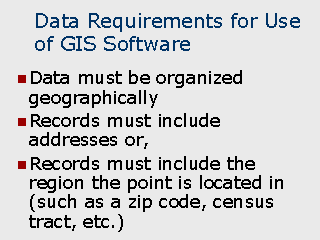 |
In order for GIS software
to be useful in a study, the datasets to be mapped must include the appropriate
information (assumes that datasets is based on point locations or events):
Although the records may not have been originally organized around geography, the capability must exist to convert them to this approach. For example, if a database contains one record for each individual who died from a particular disease, organizing these records geographically could be done in a variety of ways: If the record contains an address, it can be geocoded and presented as a specific point location. Once geocoded, regions (such as zip codes, census tracts, or block groups) can also be readily appended . If the address is not present but a relatively smaller region (such as a block group) is present, the record can be geocoded based on the centroid of the region. If, however, the study requires that you summarize the numbers of deaths by region and then relate the numbers of cases to other data related to those regions, the points must be aggregated to the regional level. This can be accomplished by many GIS programs which provide the capability to aggregate records to the region level. If the GIS program does not provide this capability, a database management system such as Microsoft Access or Visual Foxpro can be used. This approach would be useful in situations where you wish to summarize the numbers of deaths in each block group and then calculate a death rate by using the population for each block group. |